Why there are Amazon links here: Brave Review is paid a commission for qualifying Amazon purchases made through the links below. Your price does not change, and using our links is entirely optional. How this works
Best LiDAR Navigation vs Camera Navigation Systems for Robots and STEM Builders
LiDAR navigation versus camera navigation is the first real decision any robot builder faces, and the answer usually depends on budget, indoor versus outdoor use, and how much processing power the platform can spare. LiDAR delivers direct range measurements in low light, while cameras add color, recognition, and depth at a lower hardware cost. This roundup covers five verified picks spanning a bare 2D scanner, complete AI robot kits, and a research-grade 3D sensor. Hobbyists, STEM learners, and robotics developers should start with the overview table below and jump straight to the pick that matches their build.
Overview of the Picks
| Product | Key Spec | Best Use | Price Tier |
|---|---|---|---|
| WayPonDEV RPLIDAR C1 | 360-degree 2D scan, 12 m radius | Budget obstacle avoidance | Budget |
| Jetson Nano AI Vision Robot Kit | 7 in touch screen, depth camera, ROS2 | All-in-one learning platform | Mid-range |
| Yahboom MicroROS Robot Car Kit | LiDAR + TOF + AI visual recognition | STEM classroom projects | Mid-range |
| Livox Mid-360S | 3D laser radar, minimal detection range | Self-driving and UAV research | Premium |
| WayPonDEV Unitree L2 | 360°×90° scan, 30 m range, 128K points/s | Wide-angle SLAM and AGV work | Premium |
1. WayPonDEV RPLIDAR C1 360 Degree 2D Lidar Sensor

Type: 2D LiDAR scanner module
Scanning Radius: 12 meters
Field of View: 360 degrees
Intended Use: Obstacle avoidance and robot navigation
Form Factor: Ranging module kit
This is the entry point into LiDAR navigation: a bare 2D scanner that spins a single laser plane through a full 360 degrees and reports distance out to a 12-meter radius. The module ships as a kit, so buyers supply their own controller, power, and mounting. It suits a differential-drive rover or a fixed scanning station where the goal is reliable range data without camera lighting issues.
The pick earns its place as the cheapest way to add true LiDAR to an existing build, and it pairs naturally with a camera later if visual recognition is needed. The trade-off is that a single-plane 2D scanner sees only at its mounting height, so low obstacles and overhangs stay invisible.
2. Jetson Nano AI Vision Robot Kit with Lidar ROS2 Mapping

Platform: Jetson Nano 4GB
Sensors: LiDAR plus depth camera
Display: 7-inch touch screen
Software: ROS2 mapping and navigation
Form Factor: Tank car chassis
Intended Use: Teens and adults, electronics projects
This kit is the direct answer to the LiDAR-versus-camera question: it ships with both sensor types on one tank chassis, driven by a Jetson Nano 4GB and a 7-inch touch screen. The LiDAR handles mapping and obstacle ranges in ROS2, while the depth camera adds visual data for recognition tasks. It is aimed at teens and adults who want a working SLAM platform without sourcing parts individually.
The combination makes it the best single purchase for learning how the two navigation approaches complement each other in one stack. Buyers who want a finished chassis and a screen should look elsewhere, because this is a project kit that assumes assembly and software setup time.
Trade-off: The bundled compute module limits heavier AI vision workloads, so buyers planning large neural models should budget for a more powerful host.
3. Yahboom MicroROS Robot Car Kit ROS2 SLAM Mapping Navigation

Sensors: LiDAR, TOF, AI visual recognition
Display: OLED
Software: ROS2 SLAM mapping and navigation
Host: PC virtual machine support
Form Factor: Robot car kit
Intended Use: STEM learning and education
Yahboom’s kit stacks three sensing modes — LiDAR, TOF, and AI visual recognition — onto a ROS2 car platform with an OLED status display and PC virtual machine support. The TOF sensor fills the close-range gap that a spinning LiDAR often misses, and the camera layer adds object recognition. It is built for STEM learners who want to compare sensor fusion hands-on rather than read about it.
The pick suits classrooms and motivated beginners because the curriculum-friendly ROS2 stack carries over to real robotics work. The trade-off is complexity: three sensor systems mean more calibration and debugging than a single-sensor build, which can frustrate buyers expecting plug-and-play.
4. Livox Mid-360S 3D LiDAR Laser Radar
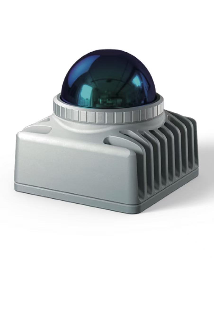
Type: 3D LiDAR laser radar
Detection: Minimal detection range design
Intended Use: Self-driving robots and UAV navigation
Form Factor: Original sensor unit
Mounting: Robot and drone integration
The Mid-360S moves from a single scan plane to full 3D laser radar, which is the category where camera navigation alone struggles most in bright light and featureless environments. Its minimal detection range design targets self-driving robot platforms and UAV navigation, where close-in awareness matters as much as long-range mapping. This is a research and integration component, not a learning toy.
It earns its place for developers who need volumetric point clouds for localization and obstacle avoidance on moving platforms. The trade-off is that a 3D sensor at this tier demands a serious compute budget, careful calibration, and integration know-how — buyers without a ROS or SLAM background will find it steep.
5. WayPonDEV Unitree L2 4D 3D Lidar Sensor Scanner
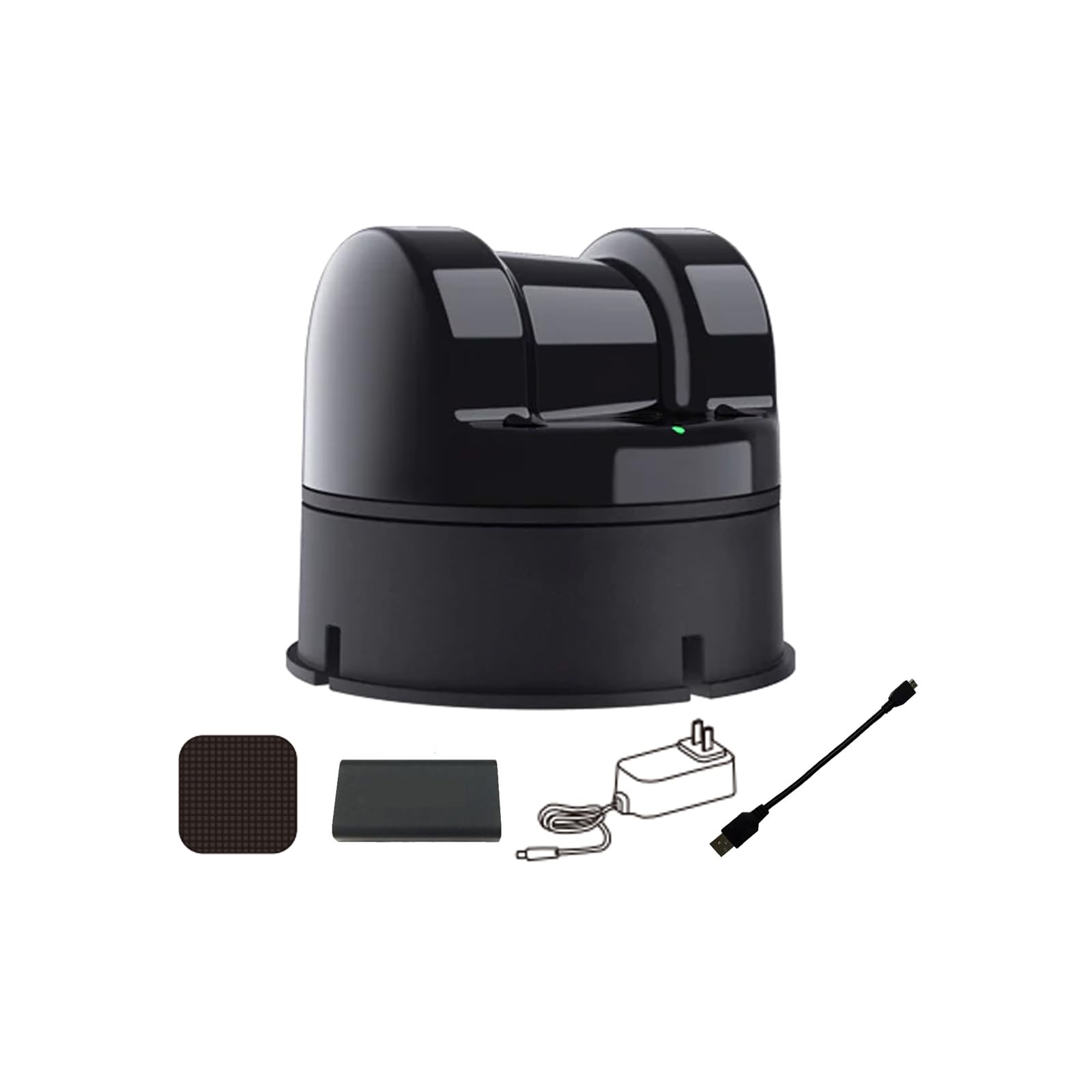
Scan Pattern: 360°×90° wide angle
Range: 30 meters (98.42 ft)
Point Rate: 128K points/s
Type: 4D 3D LiDAR scanner
Software: ROS SLAM range finder
Intended Use: Robots, AGV, obstacle avoidance
The Unitree L2 covers a 360°×90° field with a 30-meter range and a 128K points/s output, packaged as a ROS SLAM range finder module kit. The wide vertical angle is the headline: it captures ground and overhead structure in one sweep, which matters for AGVs navigating cluttered floors. It is the strongest all-round 3D option here for buyers who want broad coverage without a full self-driving stack.
It suits robotics teams building AGV or inspection platforms where both horizontal and vertical context feed the map. The trade-off is data volume — a high point rate requires real processing headroom and storage planning, so a modest single-board computer will bottleneck the sensor.
Before You Buy
- Sensor type: A 2D LiDAR handles flat-floor obstacle avoidance; 3D LiDAR is needed for UAVs, uneven terrain, and full spatial mapping.
- Lighting conditions: Camera navigation degrades in low light and glare; LiDAR range data stays consistent, which is the core argument for LiDAR in safety-critical navigation.
- Compute budget: Higher point rates and 3D clouds demand more processing power — match the sensor to the host board, not the other way around.
- Software stack: ROS and ROS2 support decides how quickly a sensor integrates; kits with prebuilt SLAM packages save weeks of setup.
- Assembly level: Bare modules require mounting, power, and wiring; complete car kits include chassis and controller but assume build time.
- Environment: Indoor hobby builds rarely need premium 3D sensors, while outdoor and self-driving projects rarely succeed with a single 2D plane.
- Expandability: Kits that already include a camera plus LiDAR let buyers test sensor fusion before committing to one approach.
Frequently Asked Questions
-
Is LiDAR better than camera navigation?
Neither wins outright. LiDAR gives precise range in any lighting, while cameras add color and object recognition at lower cost; many serious robots run both. -
Can a robot navigate with cameras only?
Yes, using depth cameras and visual SLAM, but performance drops in low light and featureless spaces, which is where LiDAR earns its price. -
What is the cheapest way to try LiDAR navigation?
A bare 2D scanner module like the RPLIDAR C1 paired with an existing rover is the lowest-cost entry into real LiDAR data. -
Do these sensors work with ROS2?
The robot kits list ROS2 mapping and navigation, and the standalone scanners are marketed as ROS SLAM range finders for integration. -
Is 3D LiDAR necessary for indoor robots?
Usually not. A 2D scanner covers flat indoor floors well; 3D pays off on UAVs, AGVs, and uneven or cluttered environments. -
What skill level do these picks assume?
The complete kits target teens and adult learners, while the Livox and Unitree sensors assume prior ROS and SLAM experience.
Bottom Line
For most buyers weighing LiDAR navigation versus camera navigation, the Jetson Nano AI Vision Robot Kit is the top pick because it puts both sensor types on one ROS2 platform and lets the buyer learn the trade-offs directly. Budget builders should start with the RPLIDAR C1, and research teams should step up to the Unitree L2 for wide-angle 3D coverage.